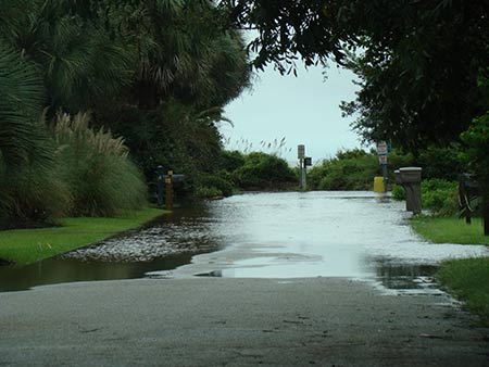
 The City of Isle of Palms participates in the National Flood Insurance Program (NFIP), and in this participation, the city adopts local ordinances whose goals are to reduce the risk of losses in the flood plain. During the permitting process, the building department will conduct a review of the applicable ordinances to ensure compliance. All new construction and substantial improvements are required to meet current flood zone standards as determined by the flood insurance rate maps (FIRM) for the City of Isle of Palms.
Zone VE
New construction and additions located in flood zone VE, Velocity Zone, and the construction drawings are required to be stamped and signed by an architect or engineer. Also, a V-Zone certification is required to be on the plans. The forms designed by FEMA are available at the building department.
Zone AE
Projects located in the AE flood zone, whether new construction or addition also typically require the stamp of an architect, unless, specifically exempted by the building official.
Flood Elevation Requirements
Within the designated flood zones AE, AO and VE there are corresponding number such as 13,14,15, etc., which determines the base flood elevation (BFE). The city has adopted a code that requires the lowest floor of newly constructed or substantially improved structures be elevated to at least the base flood elevation plus one foot or 13 feet above mean sea level, whichever is higher. This elevation is referred to as the design flood elevation (DFE). All materials used below the design flood elevation are required to be class 4 or 5 flood-resistant materials in accordance with the Technical Bulletin 2-93 as published by the Federal Emergency Management Agency. Copies of the Technical Bulletin may be obtained from the building department.
Substantial Improvement
This provision applies to existing structures which are below the minimum base flood elevation, as shown on the current flood insurance rate maps. Prior to the issuance of a building permit for repairs, renovations, alterations or additions a substantial improvement review would be conducted. The proposed improvements to the structure cannot exceed fifty percent (50%) of the appraised or accessed value of the structure, excluding the lot. For example; if the structure is appraised or accessed at $100,000 the amount of improvements allowed would be $50,000. A substantial improvement documentation packet can be obtained at the building department.
Substantial Damage/Substantial Improvement Repair/Reconstruction Affidavit
Flood Insurance Rate Maps
January 29, 2021
Official FEMA Flood Maps - Search by Property Address
The City has received notice from FEMA that new Flood Insurance Rate Maps (FIRMs) became effective on January 29, 2021
Charleston County has created a tool that allows owners to find their property and view current flood zones as well as the future preliminary flood zone that can be found here . To view the different flood zones, click on the blue “Layer list" icon on the bottom of the screen and then check either "Prelim Flood Zones" or "Current Flood Zone."
When reviewing these future preliminary maps, you may note dramatic differences from the prior maps and the proposed new ones. One difference contributing to this change is the reference elevation that these maps are based on has changed from previous flood maps from the National Geodetic Vertical Datum of 1929 (NGVD 1929) to the North American Vertical Datum of 1988 (NAVD 1988). This new reference point is approximately one foot lower. Therefore, an elevation requirement of 13 feet on an older flood map is the same elevation as 12 feet on these proposed maps. Additionally, the City has a local requirement that requires an additional foot of elevation above the FIRM requirement, which improves the City's Community Rating System (CRS) score and provides for a flood insurance discount for property owners.
Because most of the elevation requirements will be lower under these new maps, City Council enacted a local ordinance that establishes a minimum finished floor elevation standard for new construction of at least 14 feet above mean sea level (NGVD 1929). This standard will help to maintain the disaster resistance of the community and may provide for additional insurance discounts for property owners.
If you have specific questions about the flood regulations as they pertain to your property, you may call the Building Department at 843-886-9912. This site will be updated on public meetings as they are announced.
updated July 27, 2021
April 18, 2018 - End of 90-day appeal period; all comments and appeals must be received by FEMA by this date.
Appeals: FEMA outlines specific reasons for an appeal and required supporting evidence for an appeal to be considered. All submittals are considered comments unless backup documentation is provided. Please refer to this link for detailed information, or go to the FEMA website and search "Criteria for Appeals of Flood Insurance Rate Maps".
***Please note, SCDNR has requested to receive appeals and comments on an ongoing basis, as they are received and reviewed by the jurisdictions or the county. SCDNR will review all comments and appeals before forwarding to FEMA.
Charleston County has opened a phone line to answer questions from citizens.
Flood Hotline: 843-202-6957